


What Students Notice When You Actually Send Them Outside
I've always loved maps. As a geography teacher, I've taught mapping lessons before, but this time I wanted to try something different: instead of having students read and learn about what geographers do, I wanted them to actually do it. So for one of the first lessons in our physical geography unit, I built a lesson around exactly that — get students observing, sketching, and mapping like real geographers, using our own school grounds as the "field site."
The lesson ran in three parts: a first chunk in the classroom, a middle chunk outside with clipboards in hand, and a final chunk back in class comparing notes and reflecting. When I told my students we'd be heading outside for part of the lesson, the reaction was immediate — genuine excitement. It was a good reminder that students need more chances to get out of the classroom than we usually give them.
Letting students choose where to go
Rather than picking the field sites myself, I asked students where they wanted to map and had them agree, as a class, on three different locations. They landed on the football field, the playground, and the green area near the school entrance — three spots with genuinely different physical geography. We spent about ten minutes at each, moving as a group.
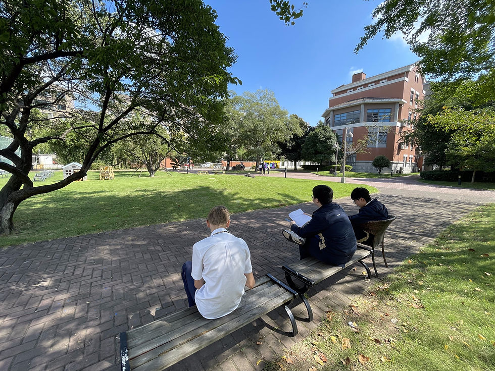
Every student took it seriously — heads down, pencils moving, actually looking at the space around them rather than just walking through it.
The moment it clicked
Nothing dramatic happened, but one small moment summed up the whole point of the lesson. A student mapping the football field noticed, for the first time, the large lamp-post structures around the track — something she must have walked past a hundred times without ever really seeing. We paused right there for a quick class debrief: "We only really start to notice things when we take the time to observe. That's exactly what you're doing right now." That's the whole lesson in one sentence.

Being honest about what didn't go perfectly
Not everything landed smoothly, and I think that's worth sharing too. Of the five map elements we'd covered in class — Border, Orientation, Legend, Title, Scale (BOLTS) — scale was the one several students forgot once they were outside sketching. Partly that's because it was the one element not already built into their printed map template. I told them not to stress about it — we didn't have any measuring equipment anyway, so precise scale was never really the point that day.
Prep tip: have your supplies ready
If I'm giving advice to another teacher trying this: get everything ready before the lesson starts. I hadn't sorted out clipboards in advance, so about ten minutes before class I was messaging every teacher in the building asking if anyone had seven clipboards I could borrow. One teacher — thank you, Ryan G.! — not only had them, but walked them over to my classroom himself. Lesson learned: sort the logistics early so you're not scrambling right before the bell.
If you teach physical geography, try this one
This lesson didn't need anything fancy — just a willingness to take students outside and let them look closely at a place they thought they already knew. If you teach physical geography and want your students to practice observation and mapping as actual skills rather than just concepts, I'd genuinely encourage you to try a version of this yourself.
I've got a fully detailed slide deck, guided notes, and a student fieldwork packet built for this exact lesson — happy to share them with any teacher who wants to run it. Just send me a message.


Comments